Case Studies
TRAFx counting systems are used for recreation, land use and visitor studies, counting vehicle traffic, trail use, bikes and off-highway vehicles (snowmobiles, ATVs, OHVs, etc). Their applications are as diverse as the environments and locations they are deployed in. Following are some brief case studies.
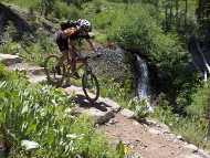
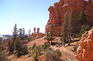
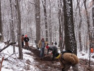
Photo Credit: TRT
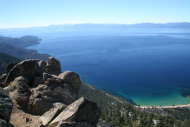
Photo Credit: TRT
Photo Credit: TRT
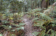
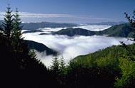
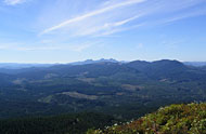
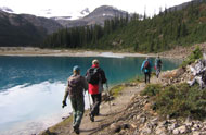
TRAFx Counters used: Infrared Trail Counter, Mountain Bike Counter
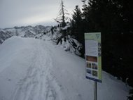
The Tahoe Rim Trail (TRT) is a 274+ km (170+ mile) trail system that encompasses the ridge tops of the Lake Tahoe Basin, crossing six counties, and two states. The TRT overlaps with approximately eighty kms (fifty miles) of the Pacific Crest National Scenic Trail and travels through the most visited Wilderness boundary in the United States (Desolation Wilderness). The Tahoe Rim Trail is a multi-user trail system shared by hikers, bikers, and equestrians.
Recreation and specifically, the Tahoe Rim Trail, is a major economic driver for the region as the local economy continues to transition from a gaming focused economy to one based on recreation and entertainment. Outdated evidence used by community leaders, suggests that well over 100,000 individuals use the trail system annually. As the Tahoe Basin’s recreation economy continues to grow and closer metropolitan population centers such as the Bay Area and Reno, NV increases it is very important to the Tahoe Rim Trail Association (TRTA), the main steward of this system, to have accurate and reliable counts of its users.
TRTA writes: Determinations from the TRAFx trail counters systems have allowed us to make informed decisions on an array of topics such as 1) the need for and ideal locations for trail connections, 2) the amount of maintenance the TRTA, partners, and agencies should anticipate for trails now and in the future, 3) how to best mitigate and reduce user conflicts, 4) whether to advocate for shuttles and public transit to reduce vehicle miles traveled to trailheads, and 5) what over saturation of on-trail events looks like.
"Since 2007 we have been conducting trail counts using TRAFx trail counters and software to make crucial determinations and couldn’t be more pleased. These counters have been vital to our Trail Operations program and we truly appreciate how great their customer service is. We have been approached by regional trail agencies and partners (Tahoe Backcountry Alliance and the US Forest Service) who wish to join us with our Trail Counter Program and couldn’t be more thrilled to share our resources with them."
Lustine L., Operations & Marketing Manager, Tahoe Rim Trail Association
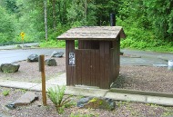
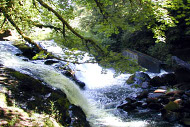
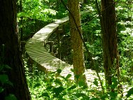
Photo Credit: Queen's Park Facilities
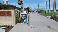
Photo Credit: Queen's Park Facilities
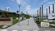
Photo Credit: Queen's Park Facilities
TRAFx Counters used: Infrared Trail Counter
The Westminster Pier Park was opened in 2012 and connects visitors to the mighty Fraser River. When combined with the Waterfront Esplanade Boardwalk, it creates a magnificent 2.5 km linear waterfront park. The Westminster Pier Park amenities include: a 600-meter waterfront boardwalk, festival lawn, concession, elevated viewpoints, grass, trees, gardens, benches, accessible picnic tables, two sand volleyball courts, a basketball court, public art, misters (spray park water feature) and two preschool-aged playgrounds. Westminster Pier Park was recognized for its remediation and design excellence through 10 awards.
Westminster Pier Park is unique with only two possible exits/entrances. Since 2015, two infrared trail counters have been used to track the park attendance. As a new park, Mayor and Council were very interested in the park’s attendance. Many reports from DataNet are used to provide information when reporting to Council, to provide accurate attendance for special events, to adjust operating hours, and to choose appropriate staffing levels for concession services. During COVID-19, from January to April 2020, between 5:00 am and 10:00 am, there were more park patrons than the same months in 2019. There were more people out walking in the morning. Monday was the busiest day of the week during COVID-19, instead of Sunday as the busiest pre-pandemic.
"We are very happy with the TRAFx infrared trail counters, DataNet software, and customer support. Westminster Pier Park attendance data continues to be critical information as we evaluate the impact COVID-19 and the construction activities have around the park."
Jim L., Assistant Manager of Queen’s Park Facilities
Photo Credit: District of Saanich

Photo Credit: District of Saanich
TRAFx Counters used: Infrared Trail Counter
The District of Saanich is the largest municipality in the Greater Victoria area of British Columbia and is the gateway to the metropolitan core. Saanich provides key transportation links to the airport, ferry terminal, the West Shore, Saanich Peninsula and the rest of Vancouver Island. There are approximately 225 km of trails spread throughout the 800 hectares of municipal parkland within the District, less than half of which are officially designated trails. The 100 km of trails are maintained by municipal staff on a four-year cycle supplemented by major capital improvements to selected trails each year. In the past, major improvements to existing trails or development of new trails was done in an ad-hoc manner. With the introduction of TRAFx counting equipment and software, Saanich is able to assess the need for new trails and improvements to existing trails based on actual numbers.
Saanich started with three TRAFx Infrared Counters and now has over ten after realizing their value.
"We have used TRAFx Infrared counters since 2011. They have provided us with excellent data for high profile projects in Saanich, giving us rationale for the decisions we need to make."
Mike G., Park Planner/Designer, District of Saanich
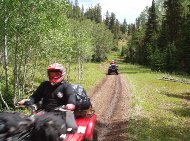
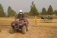
Photo credit: Fishlake NF
Photo credit: Matt Merk
TRAFx Counters used: OHV Counter
Located in south central Utah, Fishlake National Forest covers 1.5 million acres (6,070 km²), split into four districts. It was established in 1907.
The Paiute ATV Trail is the largest interconnected ATV Trail System in the United States with the main loop trail of 380 kms and an additional 880 kms of side trails that crosses three mountain ranges in four rural counties of central Utah. The Paiute connects to the Great Western Trail, the Arapeen Trail and the Fremont Trail bringing the total interconnected length to well over 3200 kms. The Paiute Trail System is primarily managed by Fishlake National Forest and the Richfield District of the Bureau of Land Management. Surrounding communities, including Richfield, Marysvale, Circleville and Salina, are linked by the trail.
Over fifty TRAFx OHV Counters are being used to gather ATV counts on approximately 2000 kms of designated motorized trails.
"Your equipment is the cat's meow when it comes to monitoring and measuring the use on our system of ATV trails. We put the last Questa counter on the shelf this summer and have switched totally to TRAFx. We thank you."
Max R., Public Service Staff, Fishlake National Forest
Photo credit: Natuurpunt
Cover removed for photograph
Photo credit: Natuurpunt
TRAFx Counters used: Infrared Trail Counter, Mountain Bike Counter
Natuurpunt, with over 100,000 members, is the largest nature conservation organization in Belgium. The long-term protection of important habitats, species and landscapes is the organization's primary goal. To achieve this, Natuurpunt buys and manages nature reserves, studies species and habitats, raises awareness and runs public educational programs, and lobbies local and regional governments. Natuurpunt's slogan is "Nature for everybody".
Natuurpunt has about 500 nature reserves totaling 22.5 km², operates 14 visitor centres, and has about 200 local branches which run thousands of activities such as nature walks, biking, exhibitions, and lectures.
Natuurpunt uses TRAFx trail counters to measure the number of people in their nature reserves. This has given them the ability to convince local and national governments to invest more in nature reserves.
"We currently have over 20 TRAFx infrared trail counters. We purchased our first TRAFx counters in 2014 and have placed several more orders since. These counters have given us the data we were looking for. Not only can we see how many people use our reserves for walking but we can also see when they visit. The service and the quality of TRAFx counters has been excellent. Before going with TRAFx we did a market study, but the value you get for your money with TRAFx couldn't be found anywhere else."
Stein, T., Nature Experience Consultant, Natuurpunt
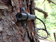
Photo credit: AEP
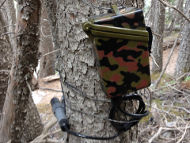
Photo credit: AEP
TRAFx Counters used: Infrared Trail Counter, Mountain Bike Counter, Vehicle Counter
Encompassing 4250 km², Kananaskis Country is located in the Canadian Rockies, near Calgary (pop. 1.24 million), Alberta. Comprised mainly of parks and protected areas, it is managed by Alberta Environment and Parks (AEP).
AEP has been using TRAFx trail and bike counters for over 17 years to monitor human use levels on trails in and around Canmore (pop. 14,000), and in Kananaskis Country. A team of well-trained volunteers currently service a suite of over 50 trail counters. TRAFx Vehicle Counters are also extensively used on Kananaskis Country roads.
“In ongoing trials, we use wildlife cameras placed in tandem with TRAFx counters to calibrate TRAFx data. Our initial results show a strong correlation between camera and TRAFx counter data, reducing the hundreds of hours often required to review and manage camera data. We also use these 30 day comparisons to develop site specific counter calibration coefficients to enhance the accuracy of our trail use estimate and refine counter locations and positioning. We plan to deploy more TRAFx counters in an array across the region to continue long term monitoring plans.”
“The TRAFx counters provide a cost effective mechanism for monitoring human use on trails.”
John P., Park Ecologist
Photo credit: TFI
Photo credit: TFI
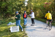
Photo credit: Thomas Photographic Services
TRAFx Counters used: Infrared Trail Counter
In a political and business environment that relies so heavily on numbers for decisions, Trails for Illinois wants to build metrics-based arguments for connecting trails that will resonate with Illinois politicians, business leaders, our neighbors and friends.
So they’ve partnered with Rails to Trails Conservancy, the University of Illinois Office of Recreation and Park Resources, and public agencies like the Illinois Prairie Path Non-Profit Corp. and Illinois Department of Natural Resources to go get the numbers that will make trails count.
To discover the Triple Bottom Line benefits—economic growth, improved health, environmental stewardship—that trails generate, Trails for Illinois developed a two-part approach:
- Measure trail use
- Survey trail users
Trails for Illinois uses TRAFx Infrared Trail Counters, and volunteer survey teams to find out:
- How many people enjoy Illinois trails, and how often
- Where do they come from
- Where are they going
- How much time are they spending on the trail
- How much money are they spending
- What’s the Triple Bottom Line potential of getting more people on the trail, from farther away, more often?
“We’re making trails count all over the state. Local volunteers are instrumental to our program so we rely on the simplicity, durability and long battery life of TRAFx counters. I can’t imagine trusting another counter deployed for months in the field.”
Steve B., Trails for Illinois’ Executive Director
Photo credit: City of Kingston
Photo credit: City of Kingston
TRAFx Counters used: Infrared Trail Counter
The City of Kingston, Ulster County, and the Kingston Land Trust collaborated to develop the Kingston Greenline, a network of urban trails, linear parks, and complete streets.
In 2017, the Empire State Trail was launched; it includes parts of the Kingston Greenline. The 1207 km (750 miles) Empire State Trail contains walking/hiking and bicycling pathways, running from New York City through the Hudson River Valley, west to Buffalo along the Erie Canal, and north to the Champlain Valley and Adirondacks.
The City of Kingston’s Health and Wellness Department was tasked with collecting trail use data. Data collection started with one TRAFx Infrared Trail counter in 2019 and then four more were installed in 2020 and 2021. Three counters are installed along the Empire State Trail in urbanized areas on pre-existing signs and posts decreasing the installation cost. Electrical boxes are used for security and anonymity and have not been tampered with.
The City has used the data to apply for state and federal grants and also has combined it with hand counts as a part of the National Bicycle and Pedestrian Documentation Project to inform the City's first Pedestrian and Bicycle Master Plan.
“Data from our TRAFx counters have helped us track the use of different segments of our Greenline network allowing us to better plan for future projects."
Emily F., City of Kingston, Director of Health and Wellness
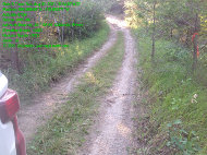
Photo credit: Rocky Mountain Forest District
Photo credit: Rocky Mountain Forest District
TRAFx Counters used: Vehicle Counter, OHV Counter
The Rocky Mountain Forest District of British Columbia, Canada (25,100 km2), includes portions of the Rocky Mountains, the Purcell Mountains, and the Rocky Mountain Trench.
It hosts a wide diversity of wildlife, hence its nickname, “Serengeti of the North”.
There are many thousands of kilometers of logging, mining, and recreational roads and trails (3,500 km Forest Service Road, 10,000 km of Road Permit Road, 10,000 km of non-status road and trails).
Eighty-nine TRAFx Vehicle and OHV counters have been used since 2014 to gather counts on road use, ATV/OHV use, and for the policing of vehicles in certain areas (eg., Motor Vehicle Hunting Closed Areas and Motor Vehicle Closed Areas).
“Your equipment has worked flawlessly for the past 8 years. The data has been invaluable for determining budget allocations and for assisting others in their patrols.”
Len P., Engineering Technician, Rocky Mountain Forest District

Photo credit: POMP
Photo credit: POMP

Photo credit: POMP
TRAFx Counters used: Vehicle Counter, Infrared Trail Counter
The Prairie Oaks Metro Park (POMP) is an area of nearly 2000 acres (800ha) in Central Ohio, USA, managed as part of the Columbus and Franklin County Metropolitan Park District. The park features nearly 500 acres of lush prairies and grasslands. In late summer and early fall, visitors can see fields of beautiful flowering ashy sunflower, royal catchfly and purple coneflower against a backdrop of big and little bluestem and Indian grasses. The spectacular and lush scenery of the Big Darby Creek a State and National Scenic River, which flows through the park, provides a beautiful backdrop for outdoor adventure.
POMP writes: TRAFx counting equipment is used throughout our Park District to obtain accurate data about visitor's usage along trails and in park areas, along with visitation during special programs/events.This data allows managers to have a better understanding of how visitors utilize park facilities. By analyzing the information managers can schedule maintenance projects, and adjust foot, bike, and vehicle patrols to meet law enforcement objectives for our Park District. The versatility of these counters has assured our ability to relocate units in remote areas in our parks and along our trail systems, which have been efficient and cost effective.
"We have been using the TRAFx system for 10 years. We originally purchased 3 infrared trail counters and 1 vehicle counter. Since that time we have grown to using over 10 infrared trail counters and 10 vehicle counters. The counters are easy to use, durable, and accurate! Their commitment to customer service, seeking feedback from the field and using the latest technology to improve their equipment/software has provided a phenomenal counter."
Tom C., Park Manager, Prairie Oaks Metro Parks, Columbus and Franklin County Metropolitan Park District.
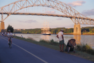
Photo credit: USACE

Photo credit: USACE
TRAFx Counters used: Vehicle Counter, Infrared Trail Counter
In addition to its navigational usage, the Cape Cod Canal is operated as a public recreation area. US Army Corps of Engineers Park Rangers provide recreation and public education programs for the nearly 3 million visitors who come to the Canal each year. Corps of Engineers operated recreation facilities include parking areas and comfort stations at various access points to facilitate public usage of the Canal for saltwater fishing, hiking, bicycling, picnicking, ship watching and other recreational pursuits. Service roads along both sides of the Canal offer bicycling, in-line skating, jogging and fitness walking opportunities for the enjoyment of our visitors.
"We began using TRAFx counters in 2009. They have been ideal because of their ease of installation and low maintenance. Additionally, the Datanet software is invaluable for compiling visitation statistics and reports. Currently, we utilize 16 units to collect visitation throughout the Canal project. I have been overwhelmingly pleased with TRAFx; their products and customer support have been exceptional."
Jonathan D., Park Ranger, US Army Corps of Engineers
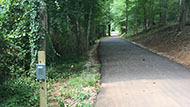
Photo credit: Partners for Active Living
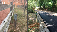
Photo credit: Partners for Active Living
TRAFx Counters used: Infrared Trail Counter
The Daniel Morgan Trail System in Spartanburg, South Carolina is a developing, 51 km (32 mile) connected network of multi-use trails. As trail segments are built, TRAFx infrared counters are being included as part of the implementation.
Tracking use over time from implementation has given insights into demand especially during the COVID19 pandemic. The data has been used to support fund-raising efforts for new trails spearheaded by Partners for Active Living, a non-profit organization.
“Trail data has really expanded our ability to tell the story of the use of our trails. Continued growth in use has shown in real terms the importance of trails in our community.”
Ned B., Trails Coordinator, Partners for Active Living
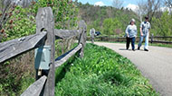
Photo credit: Great Parks of Hamilton County
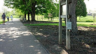
Photo credit: Great Parks of Hamilton County
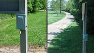
Photo credit: Great Parks of Hamilton County
TRAFx Counters used: Infrared Trail Counter, Vehicle Counter
Great Parks of Hamilton County is comprised of 21 parks and preserves spread over nearly 17,000 acres across the greater Cincinnati area. The park district maintains more than 110 kms (70 miles) of shared-use, horse, fitness, mountain bike and nature trails for the public to enjoy. In the spring of 2014, Great Parks installed 12 TRAFx Generation III trail counters on shared-use trails – as well as one vehicle traffic counter – to gather important dispersed recreation data for one year. The data will be used to help Great Parks determine trail planning and priorities, and more counters will be added in 2015 for continued monitoring.
"We use our TRAFx trail and vehicle counters in both summer and winter, and they have performed well all year round. The counters have allowed us to gather important dispersed recreation data. With more than 70 miles of trails, we will be adding more counters to our inventory this year. Very reliable!”
Vaughn M., District Recreation Manager, Great Parks of Hamilton County
Marsh Creek. Photo credit: EBRPD
Contra Costa Canal. Photo credit: EBRPD
TRAFx Counters used: Infrared Trail Counter, Vehicle Counter
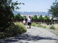
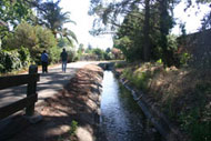
East Bay Regional Park District (EBRPD) is a system of public parks and trails in Alameda and Contra Costa counties. The system encompasses 4,520 square kms (1,745 square miles) on the eastern side of San Francisco Bay.
It is the mission of the East Bay Regional Park District to preserve their heritage of natural and cultural resources, open space, parks and trails for the future and set aside park areas for enjoyment and healthful recreation.
"We have over one hundred miles of multi-use trails that connect many cities in two counties. Many of those trail sections are along transit corridors. We have about 50 TRAFx counters and have used them successfully since 2008 to help us assess the actual number of trail users in some key areas. The information has been one of the most important resources for acquiring some of the missing pieces in our system and helping people to get out of their cars and onto the trails."

Anne R., Unit Manager, Regional Trails and Work Alternative Programs, EBRPD
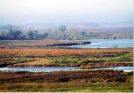
Photo credit: Jack Bartholmai
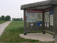
Photo credit: USFWS
TRAFx Counters used: Vehicle Counter
At over 33,000 acres in size, Horicon Marsh is one of the largest freshwater marshes in the United States. The marsh provides habitat for endangered species and is a critical rest stop for thousands of migrating ducks and Canada geese. It is recognized as a Wetland of International Importance, as both Globally and State Important Bird Areas and is also a unit of the Ice Age Scientific Reserve.
The northern two-thirds of Horicon Marsh is managed by the U.S. Fish & Wildlife Service as the 22,000 acre Horicon National Wildlife Refuge. The southern third of the marsh is managed by the Wisconsin Department of Natural Resources as the Horicon Marsh State Wildlife Area.
TRAFx counting equipment is used to track visitor numbers on the Refuge, at auto tour and viewing areas.
"We have two counters housed in wooden locked boxes along the side of the road and two counters that are buried. We like the ease of the counters and the fact that there are no tubes that go across the road, which used to get chewed up by the mowers! The installation and set up was also very easy, and they are reliable!"
Diane K., Assistant Refuge Manager, Horicon National Wildlife Refuge
Photo credit: CFI
Photo credit: CFI
TRAFx Counters used: Infrared Trail Counter
Colorado Fourteeners Initiative (CFI) protects and preserves the natural integrity of Colorado’s 14,000-foot peaks through trail maintenance and stewardship. In the summer of 2014, CFI installed five TRAFx infrared trail counters on trails with access to seven different peaks to monitor fluctuations in hiker traffic. CFI plans to implement ten TRAFx counters on several additional peaks in 2015. The data collected from these counters will be used to help CFI determine future trail maintenance priorities and have a better understanding of exactly how hiking impacts & damages trails. This information could also be used to inform the public about trends in peak traffic across the state.
"We love the counters, and we are really excited about the stuff that we have been doing with them."
Morgan, C., Development and Programs Coordinator , Colorado Fourteeners Initiative
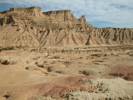
Photo credit: Bruno Barral
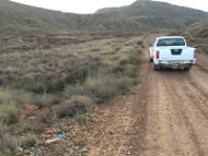
Photo credit: Bardenas Reales Natural Park
TRAFx Counters used: Vehicle Counter
Bardenas Reales Natural Park is located in northeast Spain. It is a UNESCO Biosphere Reserve. The landscape is semi-desert landscape and covers approximately 40,000 ha. The area is characterized by unusual and beautiful natural landforms. According to UNESCO, Bardenas Reales "is cold desert in the heart of Europe, where the conditions of the great central Asian steppes are reproduced". It is a "European Red Natura 2000" Special Bird Protection Area, and is home to an abundance of birds of prey, including Griffon Vulture (Gyps fulvus), the Egyptian Vulture (Neophron percnopterus), the Golden Eagle (Aquila chrysaetos) and Eurasian Eagle Owl (Bubo bubo). Recreational activities in Bardenas Reales have increased sharply. Although small, the area receives more than 130,000 visitors annually. Conservation of its unique ecosystem, and its endangered species requires careful management of public uses.
"We are currently using twelve TRAFx vehicle counters to study how recreational activities might affect the distribution, abundance, demography and behaviour of vertebrate species. Ultimately, the data produced by the counters helps managers make informed decisions regarding conservation at Bardenas Reales Natural Park."
Dr. Ainara C., Biodiversity Chair, CIBIO-InBIO
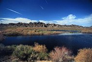
Mesquite Point at Imperial NWR Photo credit: Glenn Thoreson via USFWS
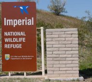
Photo credit: US Fish and Wildlife Service
TRAFx Counters used: Vehicle Counter, Trail Counter
Established in 1941, the 104 sq. km (25,768 acre) Imperial National Wildlife Refuge protects wildlife habitat along 48 kms (30 miles) of the lower Colorado River in Arizona and California, including the last unchannelized section before the river enters Mexico. The Refuge is an important sanctuary and breeding area for migratory birds and other wildlife. The river and its associated backwater lakes and wetlands are a green oasis, contrasting with the surrounding desert mountains.
The Fish and Wildlife Service uses the TRAFx counters to track the visitor usage at their major recreation areas.
"We have your traffic counters in plastic irrigation boxes buried on the Refuge. They are very reliable and inexpensive and easy to maintain, even in our extreme heat. Thank you so much for a great product."
Denise B., Visitor Services Manager
Pink Ledges Trail, Red Canyon, Dixie NF, UT, USA Photo credit: Dixie NF
ATV rider on Markagunt ATV system Photo credit: Dixie NF
TRAFx Counters used: Vehicle Counter, OHV Counter, Infrared Trail Counter
The US Forest Service manages its system of National Forests for various public “benefits”, including certain recreational uses (e.g., hiking and hunting) and industrial uses (e.g., logging). The two million acre Dixie National Forest is located in southern Utah. It is the largest National Forest in Utah. The Forest is divided into four geographic areas, and includes desert-like landscape at 854 metres (2,800 ft.) and snow-capped peaks at 3452 metres (11,323 ft). Dixie National Forest’s diverse geography hosts a wide range of recreational activities including camping, hunting, snowmobiling, hiking, canoeing, water skiing, etc. Dixie National Forest began using TRAFx Counters in the summer of 2004 to gather quantitative data regarding visitor use levels in specific areas of interest.
"We use our TRAFx counters in both summer and winter. They have performed well all year round, and have allowed us to gather important dispersed recreation data for our National Forest."
Nicholas G., Recreation Specialist, Dixie National Forest
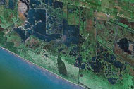
Satellite image of refuge region
Photo credit: Rockefeller Wildlife Refuge
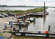
Photo credit: Rockefeller Wildlife Refuge
TRAFx Counters used: Vehicle Counter
Rockefeller Wildlife Refuge consists of 72,000 acres of coastal wetland marshes, at the terminus of the Mississippi Fly, in Southwest Louisiana. With its vast expanses of brackish, intermediate, and salt marshes, the refuge provides wintering habitat for thousands of wintering waterfowl. Due to the combined destructive forces of global sea level rise, salt water intrusion, and hurricane impacts, coastal Louisiana suffers severely from coastal land loss and erosion. Active marsh management practices implemented at Rockefeller Refuge have helped to lessen the effects of these destructive events.
The coastal marshes are home to many commercially and recreationally important estuarine organisms, which make them popular with recreational users seeking opportunities to harvest fish, blue crabs, and white and brown shrimp. Rockefeller Refuge biologists have been using TRAFx Vehicle counters since 2003 to document patterns in recreational use at public boat launches and wildlife drives.
“TRAFx Vehicle Counters have helped us tremendously in monitoring and documenting annual activity patterns of recreational users on Rockefeller Refuge. We’ve had these units in place since 2003 and they have worked flawlessly. Customer service has been phenomenal. They actually updated their software to accommodate my specific needs. I would definitely purchase these units again.”
George M., Wildlife Biologist, Louisiana Dept. of Wildlife & Fisheries
Queensland coast, Australia Photo credit: QPWS
Infrared trail counter deployment Photo credit: QPWS
Forest track, Queensland Photo credit: QPWS
TRAFx Counters used: Infrared Trail Counter, Vehicle Counter
The Queensland Parks and Wildlife Service (QPWS) administers national parks, conservation parks and forest reserves in the state of Queensland, Australia. These parks protect diverse environmentssuch as sub tropical rainforest, open woodland, swamp, heath, mountainous terrain, beaches, and rivers. QPWS has used TRAFx Infrared Trail Counters to quantify visitation on walking trails in the high usage National Parks. QPWS is currently expanding their programme. TRAFx Vehicle Counters will be also used to gather road data, and when not being used on roads, the TRAFx Vehicle Counters will be converted to the TRAFx Infrared Trail Counter with the TRAFx Infrared Conversion Kit, and used on walking tracks, horse trails and mountain bike tracks. The ability to switch between counter types is cost effective and versatile. It also gives QPWS scope to collect usage data on a variety of diverse user groups. This data will be used to aid in management decisions and also to project future useage of areas.
“Over the past three years, we have run a number of TRAFx counters along a 58 km walking track in the Sunshine Coast Hinterland National Parks. During this time we have found them to be a critical tool in the management of the track. They have allowed us to identify trends in use, (some of which weren’t foreseen!) and have been a real bonus when applying for funding, processing activity permits and developing plans.We have found the counters to be very reliable, easy to use and the after sales backup is great”.
Brendan M., Ranger in Charge, QPWS
Pacific Spirit Regional Park area, Vancouver, BC, Canada
Photo credit: Metro Vancouver
TRAFx Counters used: Vehicle Counter, Infrared Trail Counter, Pressure Pad Trail Counter, Mountain Bike Counter
Metro Vancouver is a partnership of 21 municipalities and one electoral area that make up the metropolitan area of Greater Vancouver. Its purpose is to protect and enhance the quality of life in the region through the delivery of region-wide essential services. One of these services is the management of 26 regional parks and of about 300 km of trails, as well as riverfronts and beaches throughout the region. The counting devices provided by TRAFx helps Metro Vancouver better understand visitor use patterns and use this information to improve the management of their park lands. TRAFx Vehicle Counters have been installed at most park entrances. TRAFx Infrared Trail Counters and Pressure Pad Trail Counters have also been utilized to gather trail use data.
"We have been using TRAFx counters for ten years now. We are pleased with their performance and the high-level of service TRAFx has provided. Our TRAFx equipment has become an invaluable tool for Regional Parks in the Greater Vancouver Regional District."
David A., Research Officer, Metro Vancouver
Photo credit: OMNR
TRAFx Counters used: Vehicle counter, OHV counter
Ontario is Canada’s second largest province after Quebec. Ninety percent of the 70 million hectares of forested land in Ontario is publicly owned and it is managed by the Ontario Ministry of Natural Resources (OMNR). The area managed by OMNR is approximately twice the size of Poland. OMNR are using the TRAFx Vehicle/OHV counters to study patterns of motorized recreational use and to assess the effectiveness of controls such as signs at limiting motorized vehicle use on logging roads and trails in northern Ontario. Approximately 30 TRAFx counters were deployed at various sites in the study area in 2006. This number was expanded to nearly 50 units in 2007 through partnerships with Lakehead University and Parks Canada. By 2013 OMNR was using over 100 TRAFx counters.
"We are very pleased with our TRAFx counters and the service provided by the people at TRAFx. The devices have provided reliable information for automobiles and off highway vehicles. The counters are an important part of our ongoing study in northern Ontario."
Len H., Ph.D., Research Scientist, Ontario Ministry of Natural Resources

Photo credit: IDFG
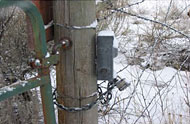
Photo credit: IDFG
TRAFx Counters used: Vehicle Counter, OHV Counter, Infrared Trail Counter
Idaho is the 14th largest state in the USA. There are three main land regions: the Rocky Mountains, the Columbia Plateau, and the Basin and Range Region. Wildlife in Idaho includes moose, black bear, mountain lion, whitetail and mule deer, elk and antelope, and various fish and bird species.
The mission of the Idaho Department of Fish and Game (IDFG) is to manage and preserve wildlife within the state. Thirty- two wildlife management areas (WMAs) and one conservation easement are open to the public for hunting, fishing, and other wildlife-related activities. IDFG has been using TRAFx counters since 2005, and uses the TRAFx Vehicle, OHV and Infrared Trail Counter.
“The main goal on the Boise River Wildlife Management Area (WMA) is to provide critical winter range for mule deer and elk. In order to manage winter range, it is crucial that we know how people are using the WMA. Through the use of TRAFx OHV and Infrared Trail Counters, we have been able to estimate how many people are using the WMA and determine where and when use occurs. These counters have been very valuable in giving us the information we need to better manage our lands.”
Zach S., Senior Wildlife Technician, Idaho Dept. of Fish and Game
Protecting old mountain maple (Bergahornbestandes) stands. Photo credit: LBV Allgäu
Information sign at the Sonnenkopf summit (1712m/5616 ft). Photo credit: LBV Allgäu

A brambling (bergfink) visiting a winter feeding spot. Photo credit: LBV Allgäu
TRAFx Counters used: Infrared Trail Counter
The Landesbund für Vogelschutz in Bayern e. V. (LBV), founded in 1909, is the oldest non-profit organisation for nature conservation in Bavaria, Germany. The organisation has approximately 60,000 members, subdivided into approximately 350 district groups. The principal aim is to ensure the maintenance of the native fauna and flora by protection of their natural habitats. Activities include: purchase and lease of threatened areas, habitat management, projects for preservation of species and habitats, nature research, statements on environmental impacts, political lobby work, public relations, visitor monitoring and visitor management, youth work, and environmental education in schools and out of schools.
The LBV uses the TRAFx Infrared Trail Counter as a people counter to count hikers, skiers and snowshoe users in the Allgäuer Hochalpen mountain reserve in the Oberallgäu region of southern Germany during both the summer and winter seasons. The count data is used to improve visitor information and education, gauge usage of remote and "unknown" paths, and determine the impact of visitation in sensitive wildlife areas, particularly the regions where the black grouse is present. LBV has used TRAFx counting equipment since the winter of 2008 and ordered additional trail counters from TRAFx in the spring of 2010.
"I used TRAFx Infrared Counters to count visitors in summer and winter. ... The day with the highest frequencies was not weekend, it was on Wednesdays. It was very astonishing for me. ... l am very satisfied with TRAFx equipment."
Henning W., biologist and conservation manager, Allgäuer Hochalpen mountain reserve
Blankets Creek trails. Photo credit: SORBA Woodstock
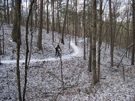
Winter riding. Photo credit: SORBA Woodstock
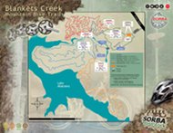
Blankets Creek trail map. Map credit: SORBA Woodstock
TRAFx Counters used: Infrared Trail Counter, Vehicle Counter
The Woodstock Chapter of the Southern Off-Road Bicycle Association (SORBA) was formed in March, 2000 by a group of local mountain bikers to build trails on US Army Corps of Engineers property on the banks of Lake Allatoona. They formed a partnership with the Corps and the Cherokee County Parks and Recreation Agency to create the Blankets Creek Mountain Bike Trails. The park has grown to 24 kms (15 miles) of excellent beginner to advanced singletrack trails. With over 100,000 riders annually it is one of the most heavily ridden mountain bike trails in the country. SORBA has partnered with the International Mountain Biking Association (IMBA) and now represents over 4,000 members who help steward miles and miles of great trails in a seven-state area.
SORBA Woodstock uses both infrared trail counters and mountain bike counters from TRAFx to get more accurate data about the number of mountain bike riders at Blankets Creek - total riders, riders by trail, time of day and day of the week they are riding. This data helps SORBA Woodstock work with Cherokee County to focus resources to support the park. For example the county recently purchased five acres of land to expand and improve the trailhead with additional parking, bathrooms, changing facilities and a pavilion. This information is also very valuable when applying for grants or corporate gifts.
SORBA Woodstock has also partnered with the City of Woodstock to build 16 kms (10 miles) of intermediate singletrack at Olde Rope Mill Park. The Taylor Randahl Memorial Trail will eventually connect with Blankets Creek to create an outstanding 48 km (30 mile) singletrack riding experience. The trail is under construction now and will have TRAFx counters installed there as well.
"We've had a very good experience working with TRAFx and have found the counters to be very reliable. We highly recommend them to anyone looking for a good counter system. The info has been invaluable for us when presenting proposals to various land managers and funding sources."
Scott S., Vice President, SORBA Woodstock
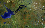
Great Slave Lake and NWT region, Canada
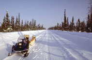
Winter road in the NWT. Photo credit: Dept. of Transportation, NWT
TRAFx Counters used: Vehicle Counter
In the Northwest Territories of Canada, seasonal winter roads, built over frozen lakes, rivers and tundra, offer an economical alternative to air supply for areas not on the regular road system. Maintenance of winter roads requires constant adaptation to unpredictable arctic conditions such as extreme cold, winter storms, visibility white-outs, overflow, wash-outs, pressure ridges, worn portages etc.
The Northwest Territories Department of Transportation uses TRAFx counters to count vehicles on their winter roads. The counters are embedded into the road, and left unattended over the winter months. Data is downloaded in the spring.
"We ordered our TRAFx system in 2004. The TRAFx Vehicle Counter has proven to be very reliable in our extreme winter conditions. For a short traffic count project like a winter road or ice crossing, TRAFx is perfect. Loop installs would take up to 1/2 a day with a 4 person crew per site every single winter for 2 months of data. TRAFx installs take less than one hour per site and just myself to install. Best data we've had in years.”
Shane L., Transportation Planner, Dept. of Transportation, NWT
Tillamook State Forest, OR, USA
Photo credit: ODF
Clatsop State Forest, OR, USA
Photo credit: ODF
TRAFx Counters used: Vehicle Counter, Infrared Trail Counter
The Oregon Department of Forestry (ODF) manages 780,000 acres of state-owned forest lands and provides forestry assistance to Oregon's 166,000 non-industrial private woodland owners. Some other activities include forest resource planning, fire protection, community and urban forestry assistance, regulation of forestry practices and promotion of forest stewardship. ODF also provides a variety of motorized (e.g., ATVs) and non-motorized (e.g., hiking) recreational opportunities. TRAFx equipment is being used to monitor recreation use patterns in a forest setting at a variety of different locations in Northwest Oregon.
“The TRAFx counting system is working well for our agency. The reliability and data collection is much easier than the tube style counters used in the past."
Bryan N., Recreation Unit Forester
Lower Lake Creek parking lot and restrooms.
Photo credit: BLM Eugene
Lake Creek Falls.
Photo credit: BLM Eugene
TRAFx Counters used: Vehicle Counter
The BLM manages more land - 256 million acres - than any other Federal agency. This land, known as the National System of Public Lands, is primarily located in 12 Western states, including Alaska. The Bureau, with a budget of about $1 billion, also administers 700 million acres of sub-surface mineral estate throughout the nation. The BLM's multiple-use mission is to sustain the health and productivity of the public lands for the use and enjoyment of present and future generations. The Bureau accomplishes this by managing such activities as outdoor recreation, livestock grazing, mineral development, and energy production, and by conserving natural, historical, cultural, and other resources on public lands.
The Lower Lake Creek area, is a popular swimming area that has a natural rock slide, and brings in huge amounts of visitors in the hot summer months. The place is being "loved to death". In order to get a sense of impact to the area, and to justify a full re-design of the traffic ingress and egress for the area, a counter system was needed to track foot and vehicle traffic, for different times of the week, and day.
"We believe TRAFx counters are the best product to use in terms of being able to get the proper set-up for accurate reading, and to provide the best data for analysis."
Wade J., Outdoor Recreation Planner
Mountain bike trail building.
Photo credit: COMBO
Raise mountain bike trail.
Photo credit: COMBO
TRAFx Counters used: Mountain Bike Counter
COMBO builds and maintains over 32 kms (20 miles) of single track on 3 trails in Central Ohio. Our trails are located just outside of Columbus so we have a large population base with access to our trails which makes our trails the most used in Ohio. The data we get from our counters allows us to more effectively lobby for more trail access and allows our bike patrollers know when the best times and days are to be on patrol.
“Before we bought our TRAFx counters we had no way to prove the amount of use our trails receive. The data we get from the counters is key to our success when lobbying for more trail access. Land managers want to know that our trails add value to their land and TRAFx allows us to do just that.”
Bryan P., COMBO
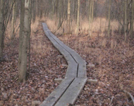
Photo credit: Natural Lands Trust
Photo credit: Natural Lands Trust
TRAFx Counters used: Infrared Trail Counters
Natural Lands Trust is a non-profit land conservation organization dedicated to protecting the forests, fields, streams, and wetlands that are essential to the sustainability of life in eastern Pennsylvania and southern New Jersey. Their comprehensive approach to conservation includes permanently protecting natural areas, providing leadership in natural resource management, and creating opportunities for people to connect to and learn from nature. To this end, 17 of their 42 Preserves are open to the public.
Natural Lands Trust currently uses 8 trail counters to track visitation at five of their most visited preserves.
“We have found the Trafx Trail counters to be an essential tool in tracking Preserve visitation and adjusting our management to protect important natural resources and ensure our visitors have a positive experience.”
Scott W., Vice President, Preserve Stewardship
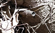
TRAFx counter camouflaged to blend in with local environment.
Photo credit: Centre Hills Project
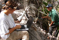
Downloading data in the field.
Photo credit: Centre Hills Project

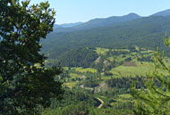
Hikers on the Oriole Walkway
Photo credit: Centre Hills Project
TRAFx Counters used: Infrared Trail Counter
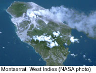
Montserrat is a small volcanic island in the Eastern Caribbean. Montserrat’s capital city of Plymouth was destroyed during volcanic eruptions that began in 1995 and more than half of the island was evacuated. The population, now less than half of its former size, has relocated to the northern part of the island.The Centre Hills Project aims to increase capacity for biodiversity and protected area management in Montserrat, particularly in the Centre Hills, a tropical forested area that escaped volcanic devastation, and is now one of the last remaining habitats for numerous threatened species, including rare tropical plants and animals.
TRAFx Infrared Trail Counters are being used on walking trails in the Centre Hills area to help determine trail use patterns, including some extrapolation of the type of trail users (e.g., hikers, farmers, etc.) based on basic tallies and analysis of timestamps using TRAFx Reporter software. The data collected by this type of people counter will help to inform the management of the area.
“The data collected by the TRAFx Infrared Trail Counters will help us to make management decisions regarding the Centre Hills area. We were able to well adapt the counters to the challenges posed by frequent volcanic activity and a hungry rat population on the island. For the first time, we now have a precise measurement of trail use, which I think will surprise people who didn’t believe that certain trails were getting so much use. These small counters are easy to install and to hide. We also like their long battery life.”
Carole M., Project Manager, Centre Hills Project http://malhe.gov.ms/centrehills/
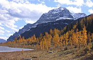
Landscape in the Pindos mountain range, Greece.
Photo credit: Alexios G.
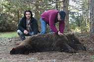
Tranquilized brown bear, Pindos mountain range.
Photo credit: Alexios G.
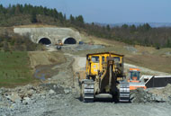
Construction of the Egnatia highway, Greece.
Photo credit: Alexios G.
TRAFx Counters used: Vehicle Counter
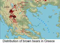
The Pindos mountain range in north-central Greece is the brown bear's (i.e., grizzly bear) southern most range in Europe. Here, a small population of bears (estimated at 115-145 individuals) exists in an environment characterized by mixed oak, black pine and beech forest, interspersed with small-scale agriculture. The brown bear is a protected species in Europe. However, two major highways, currently under construction, will cut through this ecologically important area.
The research project's main objectives are to monitor how bears use the landscape, how highway construction activities (especially noise and traffic volume) affect their movements, and whether existing mitigation measures (such as tunnels) are effective or need to be changed.

"I first learned about the TRAFx Vehicle Counter through my field activities associated with the Copeland Highway Wildlife Monitoring Project in Idaho. I thought the vehicle counter would be an excellent tool for my PhD research project in Greece. The vehicle counter will provide important data to help us determine disturbance levels in the study area."
Alexios G., PhD. student, University of Aegean, Dept. of Environment
Healy Meadows and Monarch, Banff NP
Hikers on Bow Lake trail, Banff NP
TRAFx Counters used: Infrared Trail Counter, Vehicle Counter, Mountain Bike Counter
Banff National Park, Canada’s first national park (founded in 1885), encompasses 6,641 square km (2,564 square miles) of valleys, mountains, forests, glaciers, meadows and rivers. With easy motor access, Banff NP is one of the most visited in the world: approx. 8 million vehicles enter the park annually.
Applications for the TRAFx counting system in Banff NP include: the quantification of visitor numbers on roads and trails (hiking, biking and ski trails), the monitoring of trails in wildlife-sensitive areas, and the monitoring of people and wildlife in wildlife underpasses.
Vehicle Counter / Infrared Trail Counter / OHV Counter / Mountain Bike Counter